The technologies for indoor positioning and audio description of the space around Zapt Tech enable innovative application guides, capable of guiding people with visual limitations or completely blind to walk through complex establishments to a chosen destination with voice command:
- Detailed mapping of the physical space of shopping malls, transport terminals, museums, universities, public offices or any covered establishment.
- Installation of an Indoor GPS system based on state-of-the-art BLE 5.1 beacons, with no need for power, equipped with batteries lasting 5 years or more.

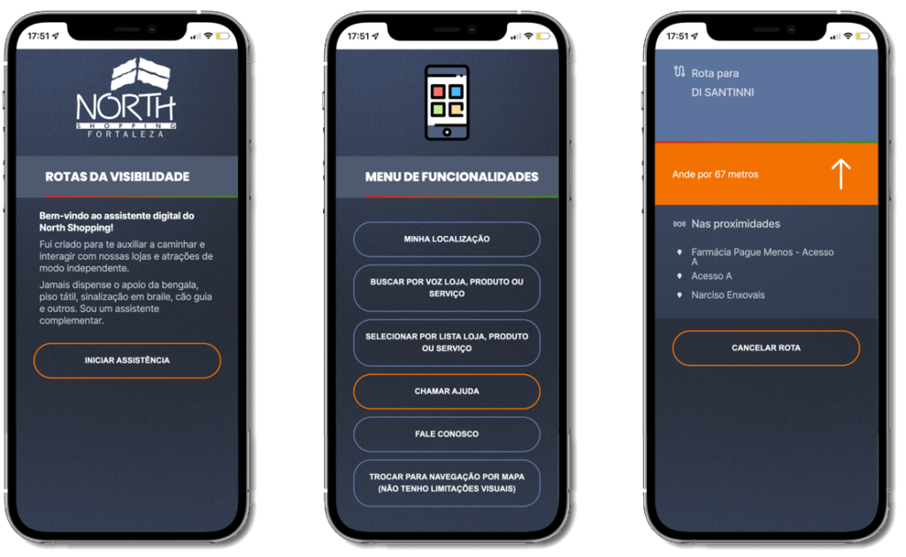
- Section-by-section guidance along chosen routes, with continuous audio description.
- Routes chosen based on the “most accessible and safe path”, not necessarily the shortest.
- Voice or touch search accessible via TalkBack (Android) and VoiceOver (iOS) in product/service categories.
- Audio description even without routes, for free walking.
- Close obstacle alerts and route deviation.
- Button for “Call Help”, triggering the route of the visually impaired for the security team to meet their aid.
Wayfindr International Standard Compliant
The open, multi-award-winning Wayfindr standard (https://www.wayfindr.net) sets distances for alerts, sounds of beep, good practices for arriving on stairs, operating elevators, among others.
O Zapt Guide for Visual Impaired People adopts the guidelines tested by Wayfindr in European countries, contextualizing them to the context of each Latin American country, such as Brazil, with the support of local specialized consulting.
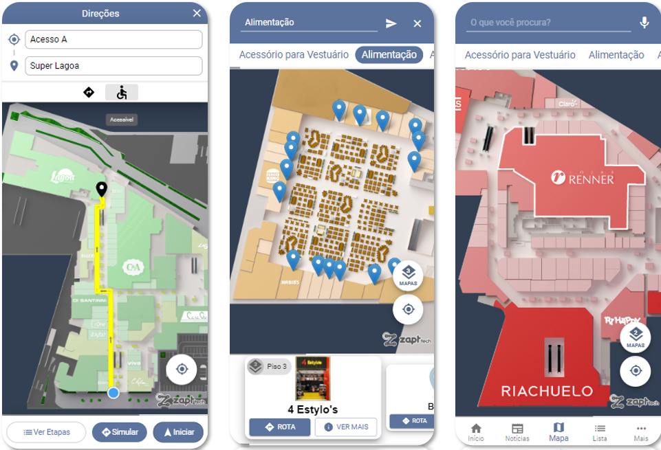
Amazing Ultra Interactive Maps with Universal Usability
Zapt Tech's indoor route mapping technologies enable guidance solutions indoor com universal usability:
- Serves audiences without visual limitations with highly interactive features on maps.
- It traces alternative accessible routes for people with limited mobility (eg wheelchair users), obtained by a single click.
- It serves people with visual limitations and completely blind.
Simplified unattended updating of maps, routes and alerts
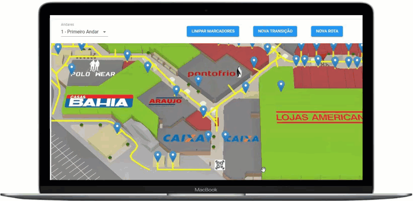
The Zapt Platform brings an online portal for users authorized by the client to change the maps autonomously, with features that allow them to change the names of stores and spaces, reorganize the polygons of the maps to subdivide or create new spaces – in addition to creating and removing alerts of obstacles for the disabled, disabling corridors, elevators or stairs that are temporarily obstructed for works, among others.
A simple command publishes all maps, routes, alerts and updated directions, in all channels: Apps, QR Code, Website, Totems...
Learn more about our special map-based solutions
What early adopters are saying...
“After losing my sight I became very dependent on family, close friends
(...) but there are certain moments when I need to have this autonomy. “
“The experience with this device is a very big step.
For me it's like it's out of reality.”
“I really enjoyed it, I was very happy. The emotion is very great.”